
Features HAUTE ROUTE ALPS
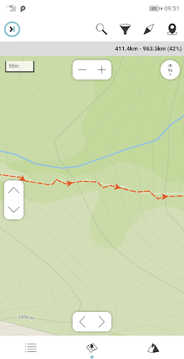
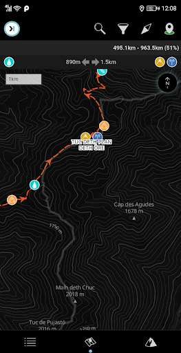
The "Haute Route" (HRA) its a long distance trail that goes from Chamonix (France) to Zermatt (Switzerland) across several Alp valleys.
The trail is well-marked and well-equipped, but its demanding physically.
If done late in the summer, can be done without crampons.You will have outstanding views of the Alps glaciers, walk through small villages and visit the two of the most known mountain towns of the Alps."Digital Hiking Guide" is the proposal of **HIKEORAMA** as an assistant in long distance routes.It includes in a single application all the necessary information in your routes.
Maps, meteorology and information of all the points that you will find along the way.
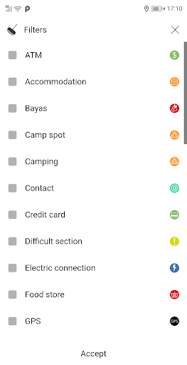
All this presented in the most accessible possible way.It will allow you to position yourself on the route and will help you to take better decisions.Summary:ATM 5Accommodation 26Camp spot 65Camping 9Contact 30Difficult section 16Food store 25Garbage 12Laundry 2Mountain pass 8Natural shelter 6Outfitter 9Pharmacy 5Phone signal 1Picnic area 14Post office 3Public transport 17Restaurant 28Roof 17Sign post 166Source 61Stealth 1Stream 48Summit 1Toilet 15Tourism office 5Vending 1WIFI 1
Travel Features
Plan and manage your travels with ease.
Food & Dining
Discover recipes and order food from your favorite restaurants.
Shopping Features
Shop online and find the best deals.
See the HAUTE ROUTE ALPS in Action
Get the App Today
Available for Android 8.0 and above